카페검색 본문
카페글 본문
-
남산-황악산-태봉산- 241109 2024.11.15해당카페글 미리보기
코스 남산-망월봉-신선봉-형제봉-황악산-선유봉-백운봉-천덕산-천룡봉-태봉산 산행거리 * 직지 m10s 2024-11-09 11:17 ** Cartographic Length = 15.221 km 산행시간 Total Time: 06:28:02 이동수단 자차 외부수신기 모델명 m10s 참고사항 웨이포인트 숫자...
-
스톰 섀도우의 러시아 영내 타격을 위해 미국의 협조가 필요한 영국과 프랑스 2024.11.20해당카페글 미리보기
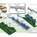
Reference Navigation system, known as Terrain Contour Matching (TERCOM), seems to rely on classified US-owned cartographic data. Without access to this data, the missiles would be forced to rely solely on their inertial navigation...
-
mapping cartograph cartography vs representation 2024.07.07해당카페글 미리보기
lved https://www.researchcatalogue.net/view/238801/238802 Aline Wiame - A Cartographic Creativity: Deleuze, Guattari, and Deligny Toward New Means of Philosophical Expression by Paulo...
-
천생산, 그리고 정자 탐방-(구미시 천생산 산림욕장 원점회기)-240427 2024.05.07해당카페글 미리보기
** Speeds in 천생산 정자 m10s 2024-04-27 10:54 ** Total Time: 05:33:35 Cartographic Length = 13.395 km 미덕암 천생산 천생산_정자 _m10s_2024-04-27_10-54_tnwjd-2.gpx 799.49KB
-
[산지니] 연결신체학을 향하여 2024.04.19해당카페글 미리보기
상실에서 생성으로』(가제) 저술 작업을 하고 있다. 주요 논문으로 「Rethinking Repetition in Dementia through a Cartographic Ethnography of Subjectivity」, 「Co-creative Affordance」, 「The Affective Creativity of a Couple in Dementia Care...
-
cartography togography geography 2024.01.07해당카페글 미리보기
s execution of choices, and is designed for use when spatial relationships are of primary relevance. (International Cartographic Association 1996, p. 1) What is Cartography? The Cartography is the art, science, and technology of making...
-
도상거리와 실제거리(Cartographic Length)? 2009.12.23해당카페글 미리보기
가민 Csx60기기나 맵소스 프로그램에서 트랙 등록정보 와 프로파일 그림에서 보여주는 거리가 도상거리임을 알 수 있는데 실제거리(Cartographic Length)를 보려면 어떻게 해야 하는지 고수님들의 조언을 부탁드립니다.
-
Korea through western cartographic eyes. 2006.06.12해당카페글 미리보기
Korea through western cartographic eyes. (unabridged version of an article written by Henny Savenije © which is released in the spring issue of Korean Culture published by Korean Cultural Center, Los Angeles, e-mail eval(unescape('%64%6F...
-
20th United Nations Regional Cartographic Conference for Asia and the Pacific 2015.10.13해당카페글 미리보기
20th United Nations Regional Cartographic Conference for Asia and the Pacific 6 - 9 October 2015, Jeju Island, Republic of Korea http://unstats.un.org/unsd/geoinfo/RCC/unrccap20.html Integrating Geospatial Information into the 2030...
-
대한민국 국가지도집, 전 세계 전문가들이 세계 최고로 평가 2023.08.27해당카페글 미리보기
국토교통부 국토지리정보원(원장 조우석)과 한국지도학회(회장 정재준)는 2023년 국제지도 콘퍼런스(International Cartographic Conference)*에서 대한민국이 2관왕을 차지하였다고 밝혔다. * 8.13.∼8.18., 남아프리카공화국 케이프타운 / 87...

![[산지니] 연결신체학을 향하여 이미지](https://search1.kakaocdn.net/argon/130x130_85_c/8Ayqer3t8u2)
